California’s SB 149 introduces a 270-day target for resolving CEQA litigation on certified infrastructure projects,...

OC Stormwater Tools
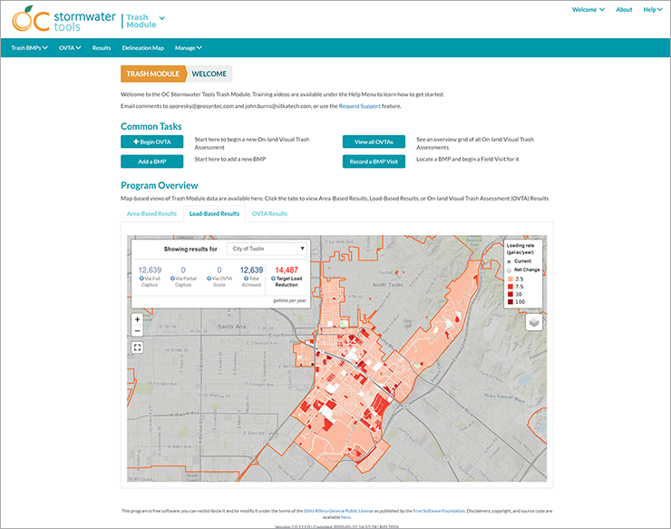
To meet requirements under the Clean Water Act, Municipal Separate Storm Sewer System (MS4) permit regulations, and the South Orange County Water Quality Improvement Plan (WQIP), Orange County Public Works must collaborate with Orange County Flood Control District and the 26 cities of North Orange County to support a program reducing pollutant discharges through the implementation of best management practices (BMPs) and other control strategies.
Why does this project matter?
The resulting H2OC Stormwater Program was designed to ensure permittee compliance and prevent pollution in regional waterways. To facilitate management of the H2OC Stormwater Program, ESA Technology Services Group was able to quickly customize and deploy our open-source Stormwater Tools platform, providing Orange County with a foundation for data management, collaboration, and administration. Like all our platforms with open-source licenses, Stormwater Tools was built using source code that can be used freely by other organizations seeking a technology solution for better collaboration and management of stormwater assets.
What is ESA doing to help?
The ESA Technology Services group partnered with Geosyntec Consultants for this project. We built a web-based solution to support the Asset Inventory, which served as a foundation for cost-effective implementation of the WQIP. Orange County Stormwater Tools also includes an Inventory Module to help jurisdictions track their Structural BMP Inventory Assets—including BMP attributes, assessments, maintenance, and funding events. We designed field data collection workflows optimized for conducting rapid assessments and capturing maintenance events.
Core to all the modules in the Orange County Stormwater Tools is a map-based delineation workflow. Jurisdictions can delineate drainage areas for distributed and regional BMPs by tracing the network directly from a digital elevation model (DEM) or by drawing a boundary using interactive web mapping tools. Geospatial data tools enable users to define location-specific queries, calculate long-term averages, view trends, compare runoff capture scenarios, and conduct paired regression analysis.
Today Orange County Stormwater Tools contains inventories and models for 16,060 stormwater BMPs, and has tracked over 15,000 field visits treating 88,000 acres.
Connect with our team
“We needed something to help track our assets, long-term implementation goals, and collaborations. We leveraged the open-source platform from ESA Technology Services to develop our own customized tool.”

Similar Projects
News & Ideas
Our experts will highlight key federal policy updates, including takeaways from the 2026 appropriations, the...
If finalized, the Waters of the United States Proposed Rule would reduce the geographic extent...
With the shutdown behind us, federal agencies and Congress are shifting back into gear and...
Kay will lead ESA’s firmwide growth strategy, aligning business development, client engagement, and marketing to...
Building on momentum from September’s Groundwater Accounting Platform Showcase, ESA, the California Water Data Consortium,...


