Why does this project matter?
CTUIR needed a technology platform to support data collection and management meeting those program standards. In 2018, they adopted our GeoOptix data management platform, becoming one of the first groups to use it in the field.
What is ESA doing to help?
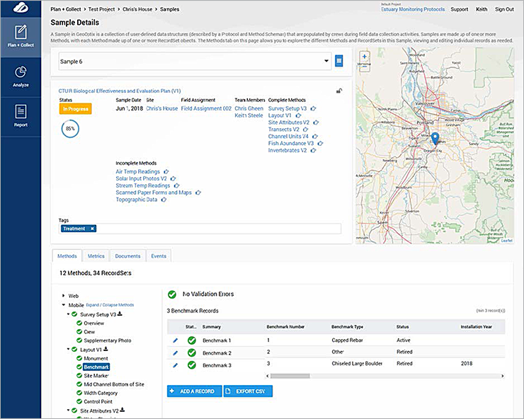
GeoOptix is a web-based platform with a mobile app to streamline workflows from collection to synthesis to long-term data management. This API-driven platform enables data collection, secure storage, and error-free data transfer. It features powerful data validation tools, along with automatic synchronization with common third-party applications such Esri ArcGIS Online and Microsoft Power BI.
At its core, GeoOptix is a hyper-nimble environmental data management repository that supports customers defining flexible schemas to describe the shape of data they need to collect, analyze, and manage over time. Existing data from legacy systems can be imported by first describing the shape of the data and then using an API to import it. This platform supports improved QA/QC of collected data, and an automated data pipeline enables post-processing to compute metrics or run externally hosted models. The platform was built to provide administrators full control of user permissions and roles at the program, project, and site levels. It also streamlines field crew management by allowing monitoring leads to assign sites to individuals, which pre-loads site information and data collection forms onto their mobile devices.
Today, CTUIR is using GeoOptix to monitor tributary habitat conditions, action effectiveness, and biological abundance and diversity. By improving data quality and streamlining their operations, the Tribe can monitor more sites, collect and analyze more data, and ultimately have much higher confidence in their evaluation and understanding of status and trends of the critical habitat they steward. GeoOptix is a versatile application that is easily integrated with other platforms, making it a useful tool in data management solutions for a wide range of users and markets.