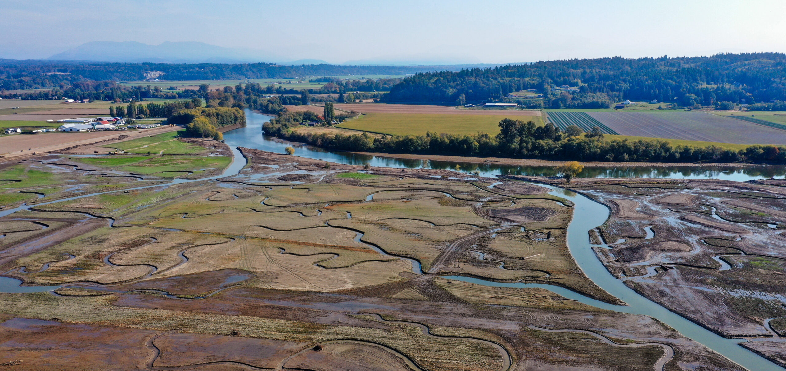
It was a crisp October day on the southern tip of Washington’s Florence Island. Along the island’s outer banks, a group of engineers, agency partners, and photographers watched as an excavator dug through mounds of sediment and soil. As the levee was breached, tidal waters of the adjacent Hat Slough and Port Susan Bay soon began to flow through reconstructed channels—a pivotal moment in transforming this former agricultural land into native estuarine habitat.
The excavation marked the seventh and final channel breach completed this year as part of Phase 2 of the zis a ba Estuary Restoration Project, a Stillaguamish Tribe of Indians (Stillaguamish Tribe) initiative designed by ESA to restore 250 acres of agricultural land to its historic estuary and create much-needed salmon habitat.
The project is among dozens of initiatives ESA’s Engineering, Hydrology, and Design group is leading across the Pacific Northwest in collaboration with tribes and local agencies, as momentum builds to restore vital wetland and salmon habitat throughout Washington and Oregon.
Transforming Lands Transformed
Often referred to as “nurseries of the sea,” estuaries and tidal habitats in Oregon and Washington are one of the most important and ecologically diverse habitats for aquatic species like salmon and steelhead. Juvenile salmonids depend on the brackish waters and surrounding vegetation to adapt to salt water, find food, and shelter from predators throughout their migration, increasing their likelihood of surviving as adults.
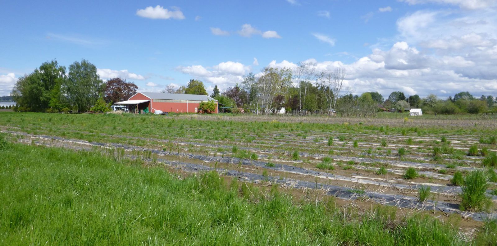
Beginning in the mid to late 1800s, settlers were drawn to these coastal locations, lured by land grants and the regions’ terrain, soil, and climate, which were optimal for farming, cattle grazing, and timber harvesting. The swamps, estuaries, and marshy tidal flats were diked and drained and transformed into pastures, orchards, and crop fields.
Over the past century and a half, this development has led to the loss of 76 percent of tidal wetland habitat and significant declines in salmon and steelhead populations along Oregon and Washington’s coasts. In central Oregon’s Siuslaw Basin, salmon runs have declined to less than 1 percent of their historic levels.
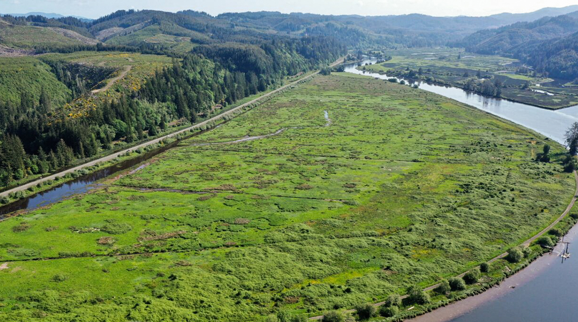
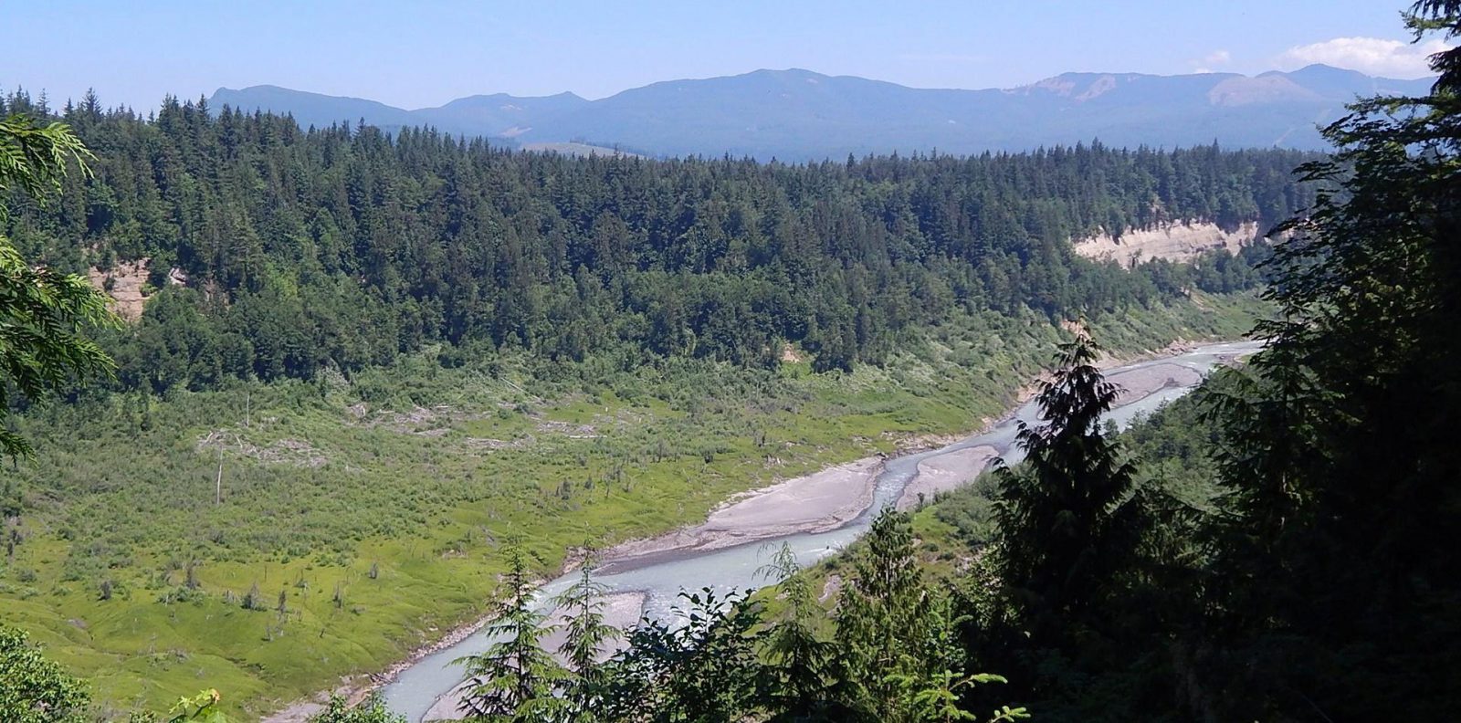
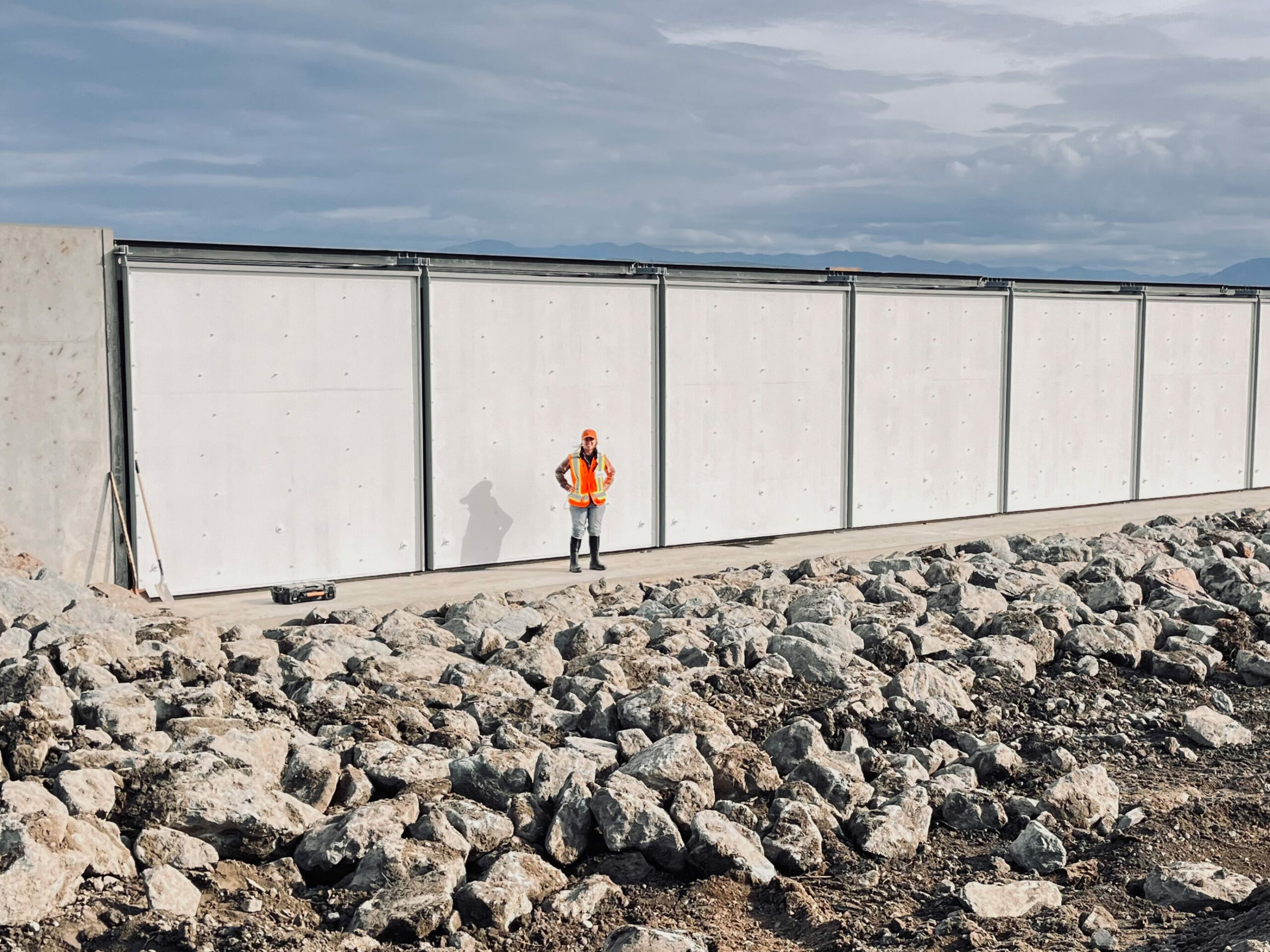
The haich ikt’at’uu Tidal Wetland Restoration Project, which completed its third year of construction, is currently restoring 217 acres of a former dairy farm in Florence, Oregon. Images by ESA and courtesy McKenzie River Trust.
This reality is of great concern to the Pacific Northwest’s indigenous peoples, as salmon has held great cultural and spiritual significance across generations. Over the past decade, coalitions of local tribes, conservation organizations, and agencies have made significant strides to remedy habitat loss and restore threatened fish populations.
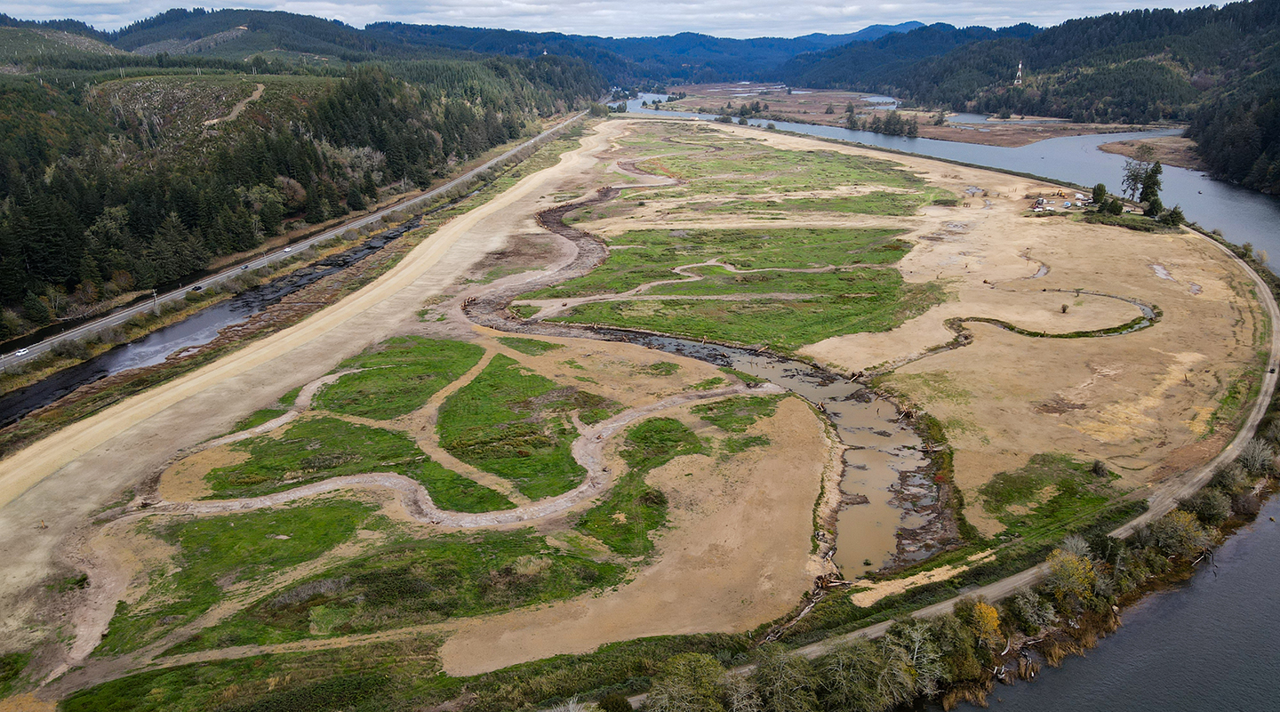
One such effort is the haich ikt’at’uu Tidal Wetland Restoration Project (haich ikt’at’uu Project) near Florence, Oregon. The haich ikt’at’uu Project, which means “heart of the river” in the Siuslawan language, is restoring 217 acres of land that was previously functioning as a dairy farm. The restoration will reestablish natural linkages to the Siuslaw River Estuary, benefiting endangered Oregon Coast coho salmon, and return it to its original floodplain marsh and swamp habitat. The project, which has involved more than a decade of planning, design, and permitting, is a collaborative stewardship between the Confederated Tribes of the Coos, Lower Umpqua, and Siuslaw Indians, the McKenzie River Trust, and Siuslaw Watershed Council.
ESA has been supporting this collaborative effort for more than 15 years, leading the project’s restoration design, engineering, and compliance, from its early planning stages through construction. Led by civil and water resources engineer Hunter White, the project design includes several key components:
- Filling the site’s drainage-ditch network.
- Excavating more than six miles of tidal channels and incorporating large wood additions.
- Removing the site’s outer dike to restore daily tidal inundation.
- Constructing a new setback dike and a fish-passable tide-gate system to protect a nearby highway and private properties, while allowing fish access to a historical slough.
- Restoring native plant species, including culturally significant species for tribal members.
Ultimately, as Hunter says, this work will reestablish floodplain connectivity and restore historical endangered Oregon coast coho salmon habitat.
“Through perseverance and collaboration by many ESA and project partner staff, the haich ikt’at’uu project will restore valuable estuarine habitat for native fish, wildlife, and bird species; while also helping to restore tribal culture, language, and stewardship of this place in the heart of the Siuslaw River.”
Hunter White, Civil and Water Resources Engineer
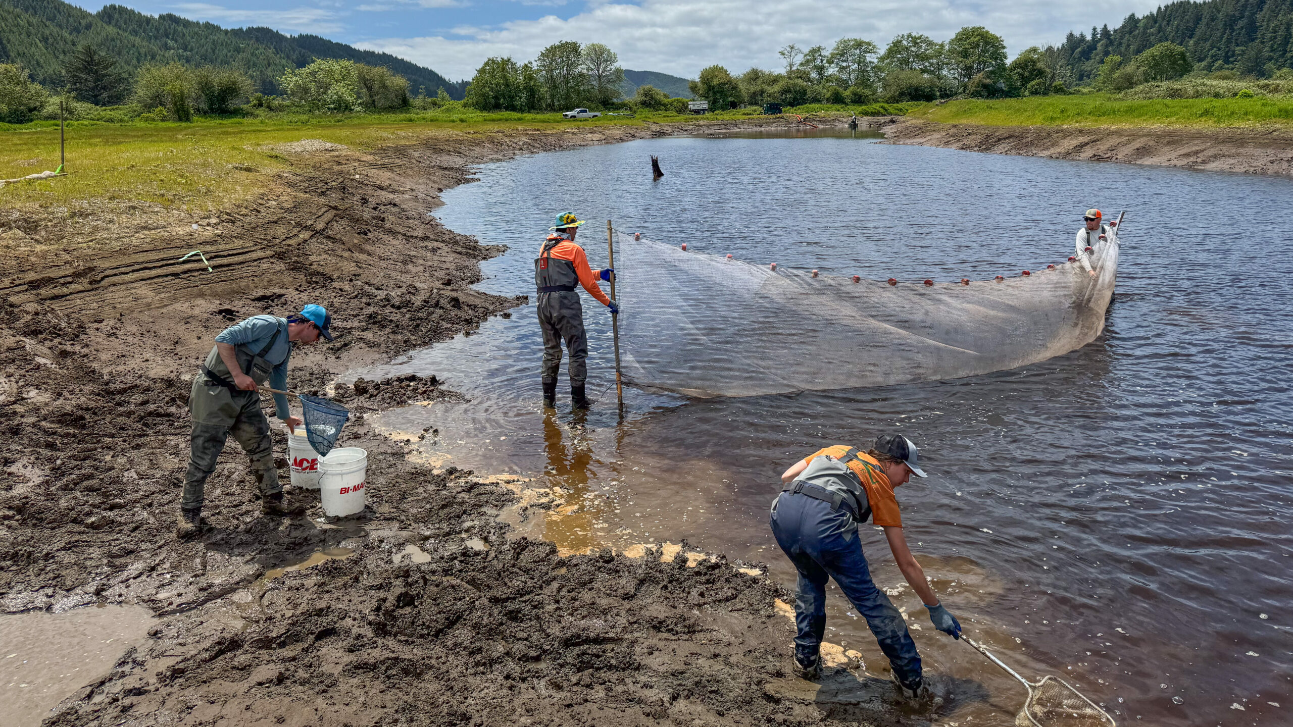
The project just wrapped up its third year of construction, completing most of the site’s interior work; it is scheduled to be reconnected to the river next summer. Over the next several years, ESA will continue assisting the client team with revegetation, maintenance, and monitoring to study how the site recovers and functions under restored conditions.
Building on Past Successes
In Washington’s Stillaguamish River watershed, the zis a ba multi-part estuarine restoration effort is already showing encouraging results, as Chinook and coho salmon have been recorded returning to the area.
Following a 2005 Chinook Salmon Recovery Plan, which identified that the lack of variable, tidally influenced habitat in the river delta was a limiting factor to Chinook salmon, the Stillaguamish Tribe acquired parcels of land around the Stillaguamish River with the vision to restore some of the area’s historical Stillaguamish Estuary.
Named after a Stillaguamish chief, the zis a ba Project is divided into three distinct phases aiming to reconnect and restore natural tidal and riverine processes along three parcels of former agricultural land on Florence Island, located near Stanwood.
ESA has been working with the Stillaguamish Tribe acting as lead designer and engineer on all three phases of the sweeping project. zis a ba Phase I was completed in 2017 and restored 88 acres of former agricultural land on the northern tip of the island. In the years following, the Stillaguamish Tribe has been monitoring the site, observing water quality and fish populations, and recorded promising numbers of juvenile Chinook salmon within the new habitat.
“Since completion, zis a ba I has fully revegetated and we’ve seen baby salmon from all Puget Sound Rivers (and one from the Fraser River) using the site. It was important to build on these successes and lessons we learned from Phase I into our design of Phase II.”
Sky Miller, Principal Engineer
Addressing Climate Risks
The engineering team, led by Dan Elefant, PE, expanded on the approach and design processes of zis a ba Phase I, and Phase II construction was completed in the fall of 2025. Located on the southern end of the island and bordered by Hat Slough, the project restored 250 acres. The operation lowered and set back levees, excavated new distributary tidal channels, and removed a 5,200-foot sea dike that was previously separating the land from the neighboring 150-acre Port Susan Bay Preserve formed by The Nature Conservancy (TNC), which ESA designed and helped construct in 2024.
In addition to reestablishing wetland habitat and hydraulic connectivity with the TNC preserve and surrounding Stillaguamish watershed, Dan says it was crucial to build in flood and sea level rise protection for the site’s neighboring farms and agricultural areas.
The area’s low-lying terrain, while ideal for farming, exists on a 100-year floodplain and is susceptible to flooding from recurrent winter storms and rising sea levels. Having worked with the area’s agricultural community for the past 30 years, Sky understood that landowners were concerned about the levee removals and future flooding risks.
ESA integrated these concerns into its design plan and replaced and rebuilt an aging floodgate with one that can quickly drain up to 4,000 acres of fields during flooding events.
Coastal engineers also incorporated habitat and wave deflection berms to deflect wave energy and better protect against erosion and sea level rise, factors which threaten the region’s agricultural production, says Sky.
“Puget Sound is already eight inches higher than when the dike and drainage system was built and is expected to increase significantly in the future. This rise is already causing salinity intrusion that negatively affects crops. This project sets the dike back and re-creates estuary habitat, and is a form of ‘organized retreat’ from Sea Level Rise,” he said.
ESA is currently working on design and permitting for Phase III, which will restore an additional 537 acres of property owned by the Stillaguamish Tribe linking the restored areas of Phase I, II, and the neighboring TNC preserve. Once complete, the zis a ba Project will have reestablished 850 acres of estuarine habitat, a major achievement in revitalizing the watershed’s ecological health.
A Landscape-Scale Approach
Across the Pacific Northwest, ESA is engaged in many other large-scale initiatives that are reshaping regional waterways to enhance salmon migration and fish passage.
Now in its third year of construction, the Washington State Department of Transportation (WSDOT) completed a project to remove six barriers at stream crossings along U.S. Highway 101 near Sequim. The $75 million projects were completed this fall, which replaced fish-blocking culverts with constructed bridges, widened stream underpasses, and redesigned fish-passable structures.
This work is part of WSDOT’s statewide initiative comprising over 500 projects to restore more than 1,000 miles of stream and fish passage blocked by state-owned highways, following a 2013 state injunction.
ESA developed the preliminary and final stream channel design, which involved assessing existing conditions and designing the placement of large woody debris to optimize rearing conditions for migrating juvenile salmonids.
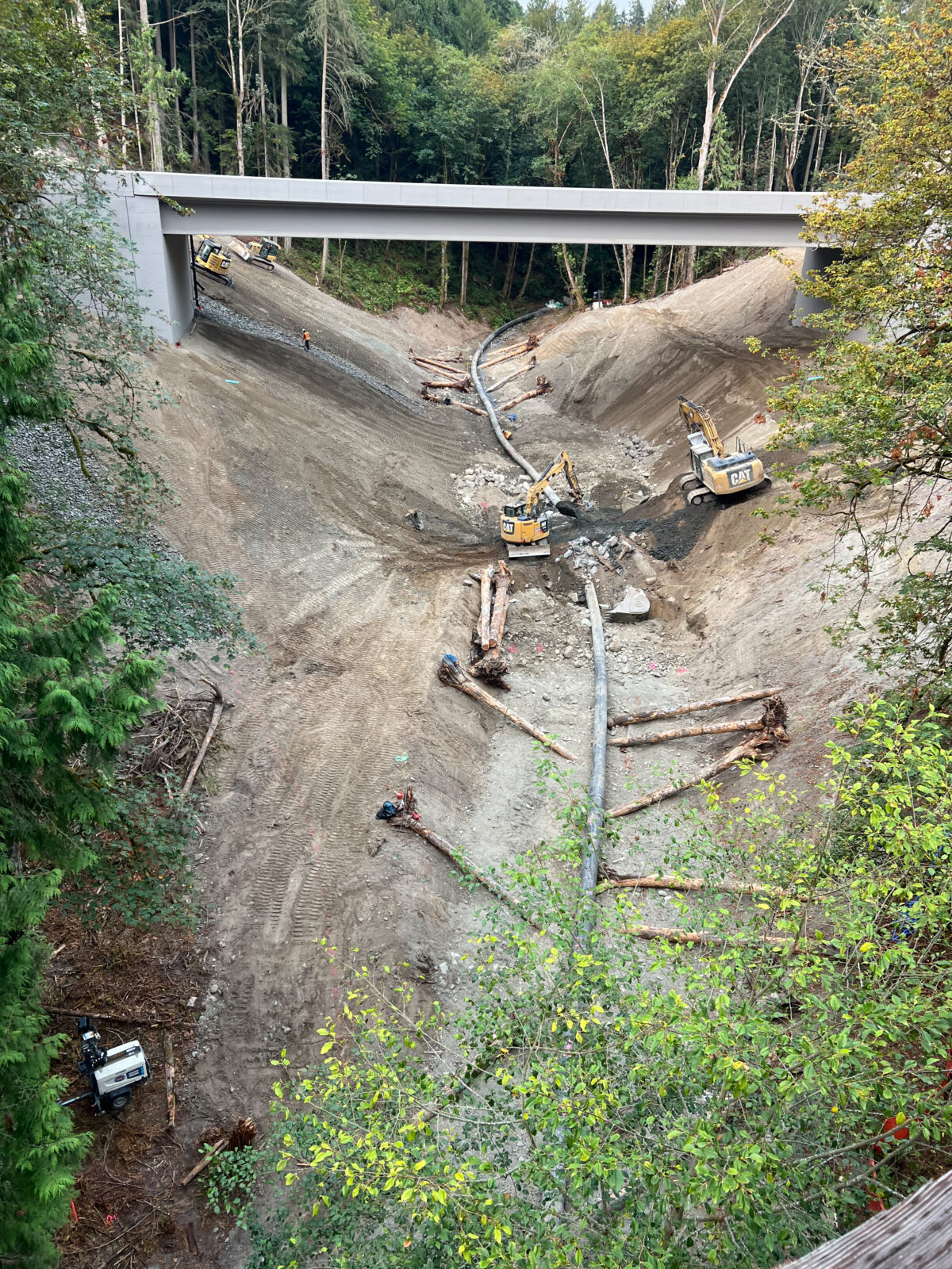
Engineers also defined stream alignment and grading and provided technical oversight throughout construction. Over the next 5 years, ESA will assist WSDOT to perform biological monitoring and assess blockages downstream on county roads.
Another landscape-scale approach ESA is involved in is on the Stillaguamish River. ESA is supporting the Stillaguamish Tribe as lead design and engineer for the Trafton Floodplain Restoration Project to restore 230 acres of floodplain along the river’s North Fork. The work involves designing and excavating distributary channels, constructing a mile of side-channel habitat, and installing more than 40 engineered log jam structures to improve spawning and rearing habitat for the federally listed Stillaguamish Chinook salmon. When completed, it will be the largest floodplain and mainstem project in the Stillaguamish River watershed to date.
For more information about how we can assist with restoration, fish passage, and wildlife connectivity projects, please contact Hunter White and Sky Miller.