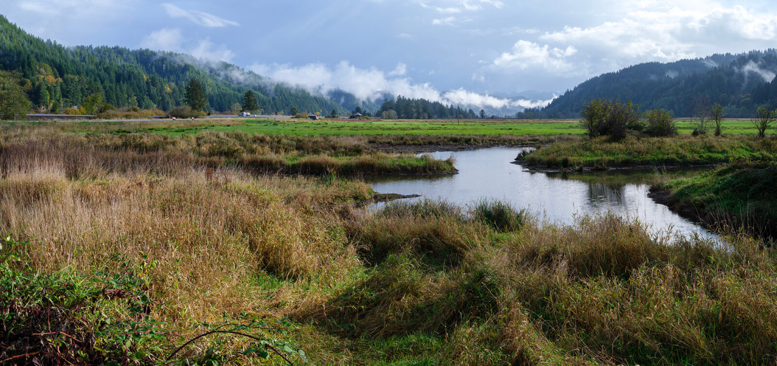
In the Puget Sound region, we spend much of our time in floodplains, often without realizing it. Floodplains are the low-lying areas adjacent to rivers, lakes, and marine waters that can be inundated during floods. Our floodplains comprise homes (many on the waterfront), businesses (such as ports and warehouse districts), our most productive agricultural lands, and many of our favorite parks and recreational opportunities. But floodplains also provide critical habitat for endangered salmon and other wildlife, most of which has been lost as floodplains have been developed. To protect and restore that habitat, it’s necessary to balance a complex web of interests, including flood risk reduction, ecosystem recovery, and agricultural viability.
ESA has worked on several programs to help manage floodplains in an integrated way along the West and Gulf Coasts. One such program is Floodplains for the Future (FFTF), an ambitious program working collaboratively to manage the floodplains of the Puyallup Watershed, which spans more than 1,000 square miles in Washington’s Puget Sound region. FFTF’s goal is to advance a suite of floodplain reconnection projects, such as levee setbacks, to give the river more room to move and to restore natural processes. The program also incorporates other important community values, including maintaining a viable agricultural land base and economy and building trust and collaboration across interests.
As a partner to FFTF, ESA developed and wrote the program’s Shared Monitoring Plan (Plan). Led by the Pierce Conservation District, the Plan is a critical component of FFTF’s work, tracking and reporting on progress toward the program’s shared goals. Using a suite of more than 20 metrics, data is collected on each metric on a regular basis. The Conservation District then analyzes the data and, after vetting with FFTF partners, posts the information at www.floodplainsforthefuture.org. ESA is now supporting implementation of the Plan, including analyses and reporting of data and results.
By monitoring not only their own actions, but also watershed-scale trends and outcomes, FFTF partners will be able to understand how actions contribute to outcomes in the watershed. The Plan will also flag other trends that may be standing in the way of achieving shared FFTF goals. This study and review will allow FFTF to scale and build a truly integrated floodplain management program and then articulate the results. Critically, the program will have the information needed to understand whether strategies are working, change the direction of investments if needed, and ultimately achieve its goals.
How are we improving floodplain health?

To develop the Plan, ESA worked with stakeholders for farming, flood, and fish interests to establish their goals and identify trackable metrics. This effort left us with three lists of metrics, one each for fish, flood, and farm, which we sought to integrate. We realized that all of the metrics, regardless of which category they represented, fit into one of three themes—investments, land, and outcomes. From there, we developed the Index of Floodplain Health.
The investments theme (green) tracks what FFTF members are investing in financially and the progress being made on identified lists and plans. Metrics include acres of restoration projects and of conserved farmland. This theme monitors those things that FFTF have control over—their own actions. But the Plan goes beyond that in its other two themes. The land theme (blue) tracks things happening on the landscape that FFTF partners don’t control, such as new built environment in the floodplain and acres of floodplain that are connected to the river and have natural land cover. Finally, the outcomes theme (brown) tracks the things that matter most at the end of the day, like salmonid abundance, dollars of flood damage, and a viable farming economy.
Part of the Plan is an annual Results Summit to discuss the information that has surfaced. Recently, more than 20 FFTF collaborators gathered at the second annual Results Summit to review the past year’s results and discuss what is currently happening in the Puyallup Watershed, analyzing complex issues related to flood damage reduction, salmon recovery, and agricultural viability. Some of the questions discussed at the summit included: How many at-risk structures have been removed from the floodplain? How many salmon recovery projects have been completed? How much actively farmed land is there in the floodplain? And, do we need to change our strategies, actions and investments based on what we’re learning?
The recent Results Summit was the first time that FFTF partners started to see the results from the Plan and, admittedly, they were not all positive. There was a low point in the meeting when people realized that the results showed that floodplain is being lost to development even as other areas are being restored and that the situation for both salmon and agriculture is dire. While it was difficult to hear, discussing this hard truth also helped raise important questions about the scale of the FFTF program and about the need to consider addressing policy issues.
At the end of the meeting, despite a day of tough conversations, everyone sat around the table joking and laughing with each other—showing that the challenges in front of the group are not deterring FFTF partners from collaborating and building camaraderie. The challenges for managing the floodplains in the Puyallup Watershed to reduce flood risk, restore habitat, and support the agricultural sector are very steep. The integrated floodplain management approach has already brought tens of millions of dollars to the issue, achieved some real and positive results (including permanently conserving over 600 acres of farmland and reconnecting over 300 acres of floodplain), and brought together a group of smart people willing to collaborate with each other despite having different interests. Ultimately, we are confident that the Plan will help the group adapt and improve the program over time to increase the scale of those results. For more information on integrated floodplain management, please contact Spencer Easton.