On April 20, 2010, BP’s offshore oil-drilling rig, the Deepwater Horizon, exploded and sank 41 miles off the Louisiana coast. Over 134 million gallons of crude oil spewed for more than 3 months, contaminating over 1,300 miles of shoreline from Texas to Florida, becoming the biggest offshore oil spill in US history.
Following a historic $18.7 billion settlement reached in 2015 between BP and the Gulf States, large-scale efforts have been and continue to be funded to recover and restore the region’s natural resources and protect against future climate threats and vulnerabilities.
For the past 10 years, ESA’s specialists have supported these oil spill recovery and restoration efforts in the Northern Gulf Coast to enhance natural resources and coastal resiliency. Our team continues to assist natural resource agencies with this essential work to restore the region’s irreplaceable habitats and ecosystems by developing large-scale watershed and long-range adaptation planning strategies, contributing to science-based engineering and research, designing nature-based solutions, and aiding in project implementation.
A Long-Range View for Watersheds in Alabama
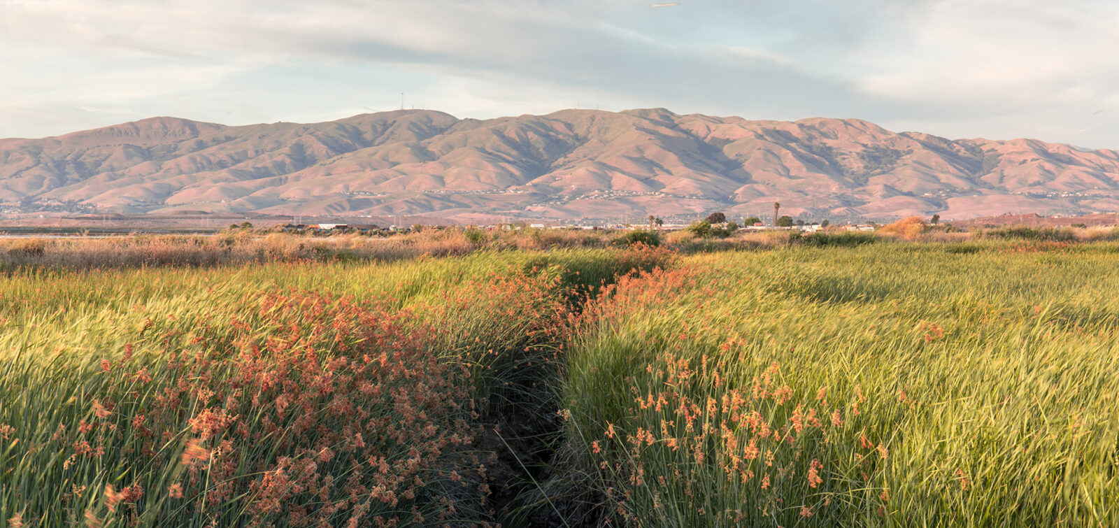
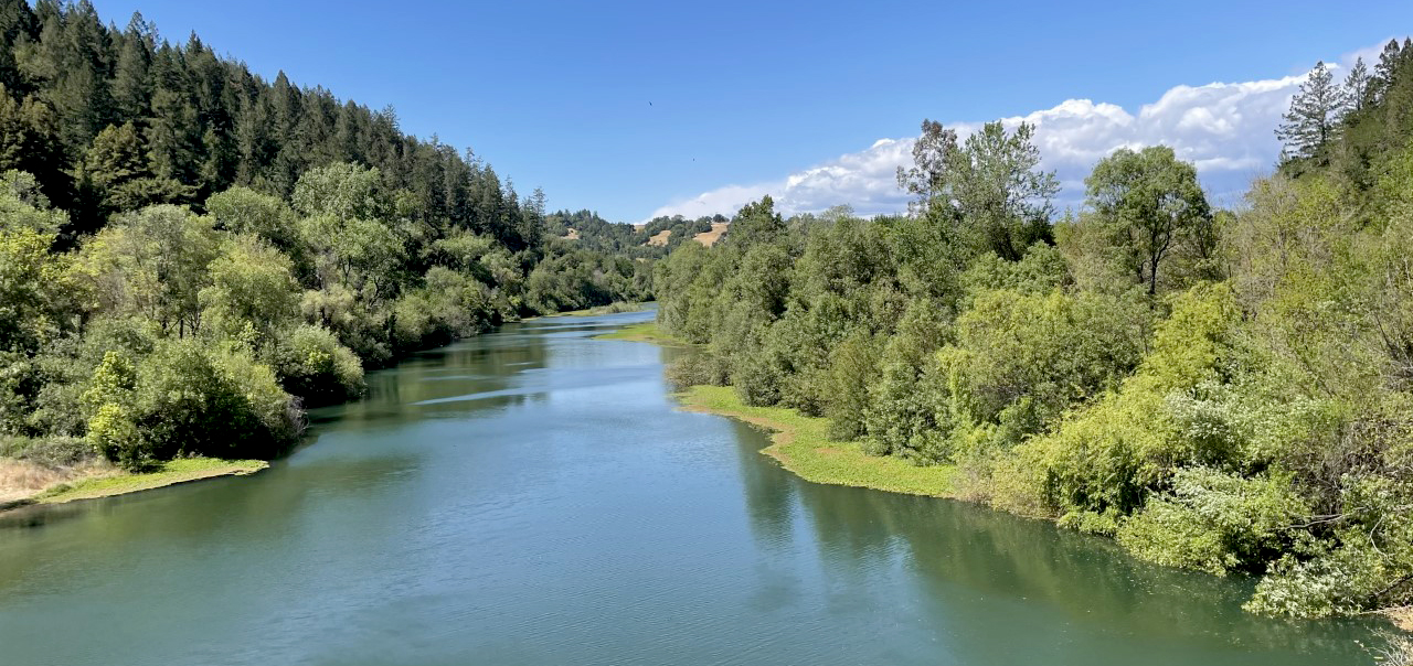
On Alabama’s coast, the widespread effects of the oil spill greatly impacted sensitive ecosystems and coastal habitats, including beaches, marshlands, and seagrass beds. Mobile Bay spans more than 413 square miles, and its marshlands, freshwater sources, aquatic species, fisheries, and recreation-based economies face ongoing stressors from degradation, development, and land-use changes, sea level rise, and storm surge.
For local natural resource managers such as the Mobile Bay National Estuary Program (MBNEP), the main objective to address these threats has focused on enhancing habitats and resilience. Beginning in 2008, MBNEP began outlining new watershed management and implementation strategies with its State of Mobile Bay report and the later Comprehensive Conservation and Management Plan. Meant to be a “holistic watershed-based approach to guide coastal ecosystem restoration and protection measures,” these comprehensive reports assessed the Bay’s environmental status and trends and identified declining watershed conditions most in need of intervention.
For more than 10 years, ESA has been a partner to MBNEP in support of the organization’s science-based mission in developing watershed management plans and designing and implementing habitat restoration and shoreline stabilization projects.
“Over the past decade, ESA has been an invaluable partner to the Mobile Bay National Estuary Program (MBNEP), supporting our science-based mission to protect and restore Alabama’s estuaries and coast,” says Roberta Swann, MBNEP Director. “Their expertise has played a crucial role in developing watershed management plans and designing and implementing habitat restoration and shoreline stabilization projects. ESA’s commitment to environmental stewardship, along with their collaborative approach, has not only benefited the ecosystem but also strengthened our local communities by ensuring a healthier, more sustainable environment for future generations.”
In conjunction with MBNEP staff and their Science Advisory Committee, ESA performed a detailed assessment of key stressors and environmental indicators in coastal Alabama estuaries and coastline for the development of the State of Alabama’s Estuaries and Coasts Report, which updates the previous 2008 State of the Bay report.
ESA conducted scientific status and trends analysis to evaluate the watershed and coastal health status. Scientists examined environmental factors like stream degradation, pollutant sources, water quality issues, habitat loss, and shoreline erosion. They also evaluated watershed health indicators and the potential risks from development and climate change. The new report provides MBNEP and agencies with a comprehensive assessment of estuarine and coastal conditions and serves as a resource for natural resource management.
Restoring Rivers in Need
ESA also supported the development of more than seven Watershed Management Plans for MBNEP for the Dauphin Island, Bayou La Batre, West Fowl River, Fowl River, Dog River, Western Delta, and Eastern Shore basins. These localized plans outline direct strategies for watershed protection and identify key actions to restore local rivers, bays, and coastlines. Working with community stakeholders, including residents, businesses, government agencies, and organizations, to identify watershed areas most at risk and prioritize restoration efforts was critical to the success of this work.
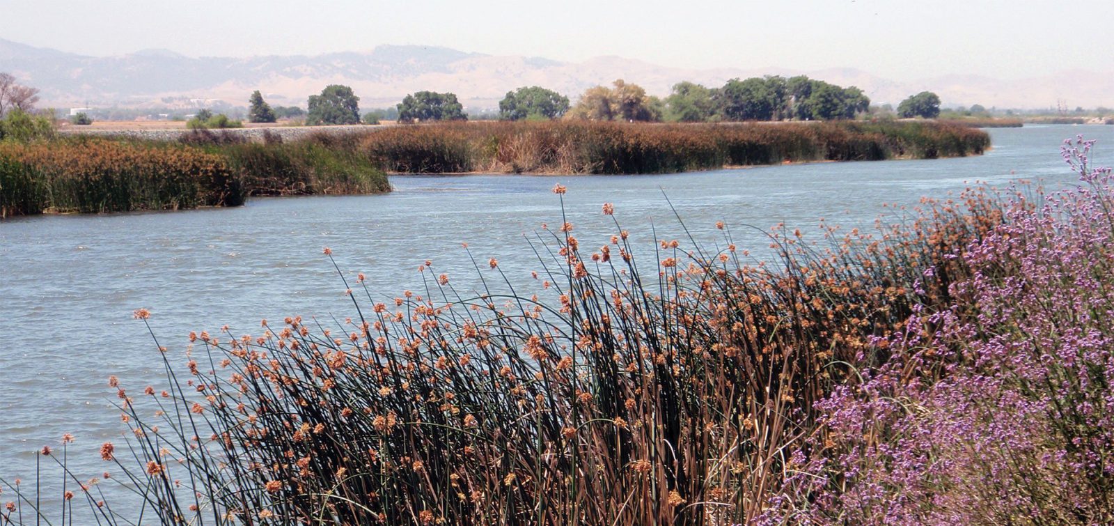
Fowl River was one such watershed in immediate need. Spanning more than 14 miles, Fowl River is defined by its intricate series of winding waterways, islands, and coastal spits as the brackish water discharges out to Mobile Bay. Spits are coastal landforms, created as wind and waves deposit sediment onto the coast and resemble narrow strips of land that jut out from the shore and extend out toward the river. They create a type of lagoon protected from wind and wave disturbance, providing important salt marsh habitat for local wildlife.
A 2019 marsh health and recovery study conducted by members of MBNEP’s Science Advisory Committee found that many factors were impacting Fowl River’s wetlands and spits—namely boat wakes, sea level rise, subsidence, increased salinity, and a lack of sediment deposition— and were threatening the integrity of these landforms and habitats.
Following development of the river’s watershed management plan, ESA was selected as design and engineering lead to develop phase one of the Fowl River Shoreline and Marsh Stabilization and Restoration project, which focuses on stabilizing five of the river’s priority spits. “Coastal Alabama is a place of unique cultural heritage and natural beauty,” remarks Chris Warn, ESA Southeast Biological Resources Director.

“Being involved in projects like Fowl River, from initial planning through design and construction is especially rewarding, as it fosters close collaboration with residents and resource agencies. This engagement provides a deeper understanding of project needs, enabling us to develop innovative solutions creating lasting benefits for both the community and the environment.”
Chris Warn, Southeast Biological Resource Director
Unlike many coastal protection measures, which involve installing hard engineering solutions such as seawalls, jetties, and breakwaters, MBNEP sought to develop natural alternatives and adaptive management strategies that could create long-lasting solutions.
Over the course of four years, ESA’s coastal engineers and scientists worked closely with MBNEP to develop nature-based engineering and design approaches to stabilize shorelines, enhance marsh habitats and restore natural processes to restore ecosystem function, and establish long-term sustainability.
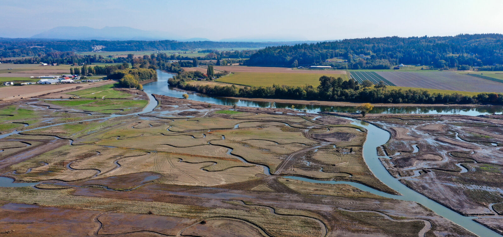
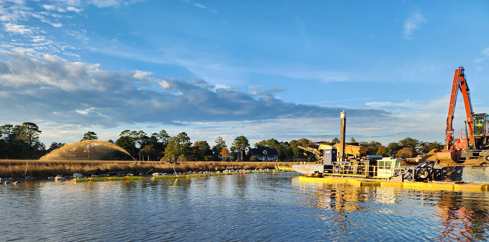
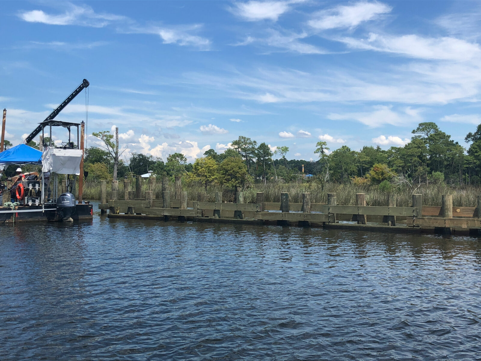
The first phase of the project focused on addressing shoreline erosion, increasing marsh elevation, and protecting seagrass. Engineer of Record Bryan Flynn, PE, designed a novel series of interventions, including timber wave screens and sediment placement to protect the spits. The wooden wave structures serve as attenuators to dissipate wave energy and protect the shoreline against boat wakes, preserve nearby seagrass beds, and aid in the natural replenishment of sediment and sand deposited onto the shorelines. Installation of a thin layer of sediment will also raise the elevation of the marsh spits to mitigate chronic submersion and saltwater intrusion into the marsh.
“The marsh spits are a unique ecosystem that is stressed by a number of different environmental factors; therefore, the design had to be unique as well,” says Flynn. “To address each factor effectively, we took a tiered approach, directly applying thin layer placement to nourish the marsh to keep pace with sea level rise and installing timber and riprap structures to dissipate wave energy at a wide range of water levels and give the marsh spits a chance to recover. This combination of hard and soft nature-based restoration solutions includes design elements that allow the marsh spits to continue to adapt in the future as sea levels rise and salinities change.”
Integrating Environmental and Community Needs
While shoreline protection and climate adaptation are at the core of restoration efforts on the Alabama coast, so too is addressing risks to local species and wildlife and managing the economic impacts that affect local communities.
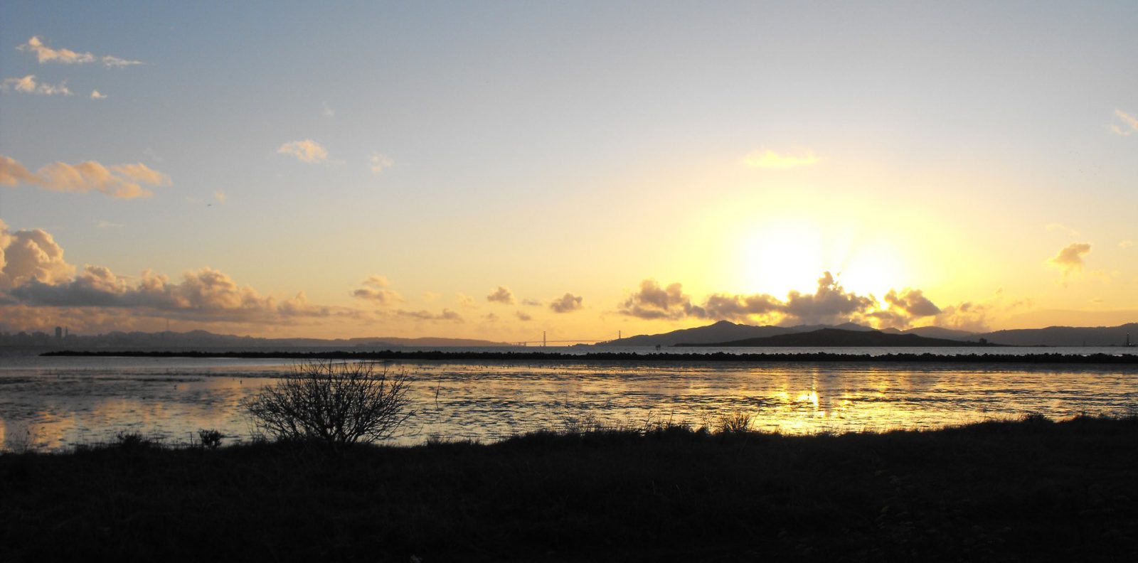
Known as “the sunset capital of Alabama,” Dauphin Island attracts residents, businesses, and visitors with its prime beach access and recreational activities. Located 3 miles off the coast, this island paradise is Alabama’s only barrier island, and provides crucial habitat for nesting birds and sea turtles. However, it is also one of the most vulnerable pieces of land in the US and is highly susceptible to climate risks such as erosion, flooding, and storm surge.
ESA worked with MBNEP to develop the Dauphin Island Watershed Management Plan. This collaborative effort involved extensive community outreach, which guided ESA’s research and identified key watershed conditions and community concerns such as flooding, sea level rise, and fish and wildlife impacts. The ESA team also conducted water quality and watershed analyses, assessed habitat and shoreline conditions, and integrated economic impacts into the plan.
In addition, ESA worked with Mobile County, the Deepwater Horizon Natural Resource Damage Assessment Trustees, and the Town of Dauphin Island to develop the Dauphin Island West End Bird Conservation and Management Plan to address increasing threats to coastal bird species, performed extensive bird and predator surveys, and developed management measures and recommendations for bird and habitat management.
The resulting plans serve as management guidance documents outlining natural resource management financing and regulatory recommendations and provide a roadmap for implementation strategies.
Progress Ahead
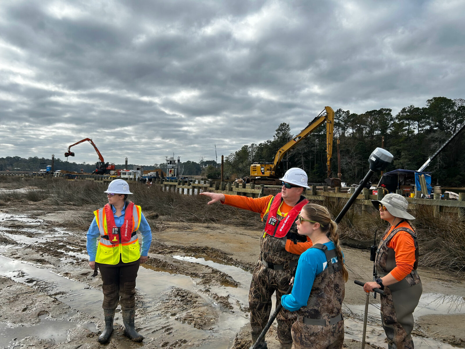
In Fowl River, the first phase of construction began in summer 2024 and is nearing completion. ESA is providing ongoing construction monitoring during the active construction phases and will perform post-construction monitoring for 5 years. Monitoring will guide adaptative management decisions and inform future nature-based approaches in the region and beyond. Phase two construction will begin later this year and includes additional placement of material on the marsh platform to address future impacts of sea level rise.
ESA is committed to creating comprehensive watershed and long-term climate adaptation plans, leading science-driven research, and crafting nature-based engineering solutions. As ongoing adaptation and coastal planning efforts are underway within the Gulf region, we look forward to continuing our decade-long partnership with our clients. For more information about this project and our work in the Gulf, contact Chris Warn.