
ProjectFirma®
Improve Data Management and Foster Collaboration with Software Customized for your Operational Needs
ProjectFirma is a community-driven, open-source software platform specifically designed to manage data and monitor results for conservation and restoration projects. This highly customizable web and mobile tool helps regional initiatives and partnerships coordinate efforts and quantify their collective impact. ProjectFirma is perfectly suited for regional organizations who need to track and share high-level details of various projects with a wide range of internal and external stakeholders.
ProjectFirma provides a foundation for the fully customized solutions we design for each client. This approach delivers the tailored fit of a custom software application without the time and cost of building from scratch.
Is ProjectFirma a fit for your organization?
Yes, if you want to track progress and results in a centralized system
Yes, if you want to quantify accomplishments and share your story
Yes, if you want to coordinate efforts and foster consensus among various funders, decision makers, and partners
ProjectFirma is ideally suited to integrate with a variety of technology systems, bringing all data and information together into a centralized system of record.
Benefits
- Foster Collaboration: Coordinate actions and resources, facilitate group decision making
- Improve Data Management: Standardize processes for data collection and record keeping to better understand expenditures and accomplishments
- Increase Efficiency: Streamline and automate common workflows to save time and money
- Tell Your Story: Engage the public with reports and a public-facing web portal
ProjectFirma Features
ProjectFirma features a comprehensive set of tools specifically designed to meet the challenges faced by environmental project managers.
Design your own custom workflows for proposing, reviewing, approving, and updating projects
Advanced data visualizations help you monitor progress and quantify results
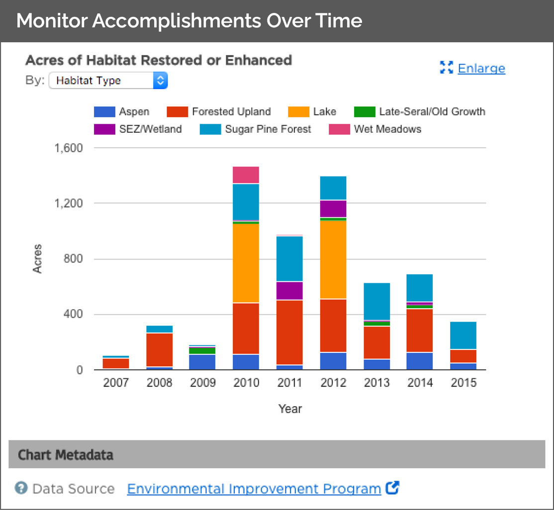
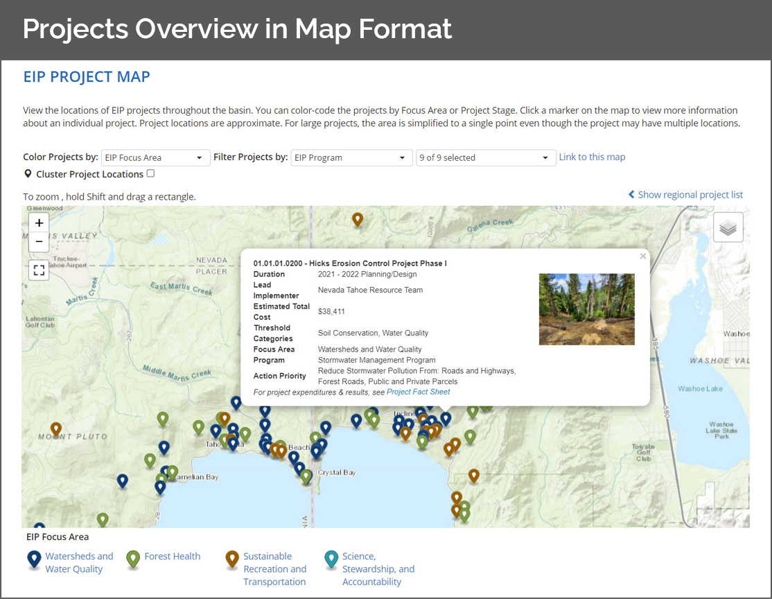
Track progress via maps, charts, and photos
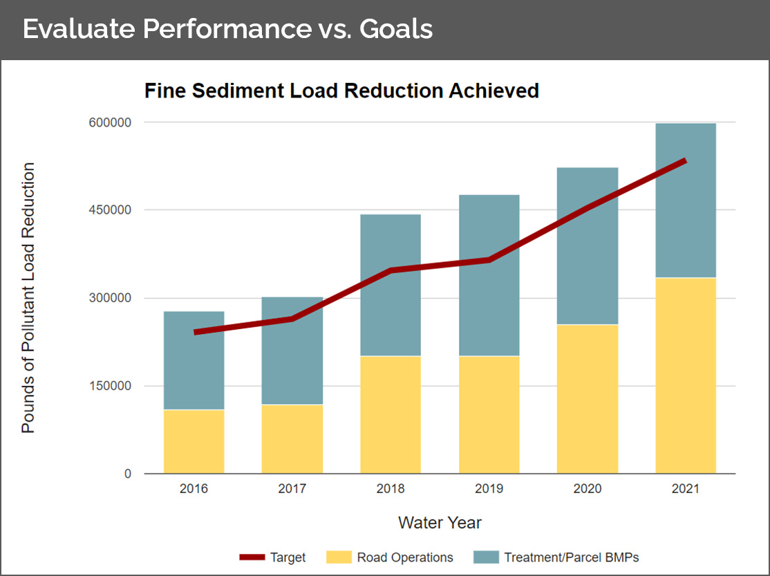
Chart project data with benchmark or target values
Data-driven analysis enables you to evaluate the effectiveness of program or priority initiatives
Simplified tracking designed to facilitate natural resource management
Associate projects with geospatial areas such as watersheds, counties, management areas, habitat zones, etc
Answer questions such as “how many acres of forested habitat have been restored this year in a particular county, using a particular funding source, or working with a particular partner?”
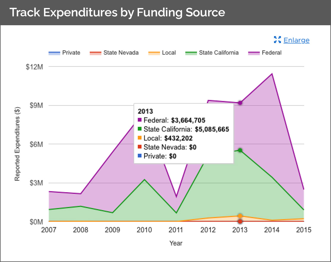
Quantifies accomplishments and expenditures by funding source
Track funding sources by organization and type
Generate reports for funders that chart their contributions with specific priorities, geospatial areas, and accomplishments
Answer questions such as “how do changes in funding levels impact project outcomes?”
Centralized source of shared data for regional stakeholders
Automatically rolls up data by program category, geography, and theme
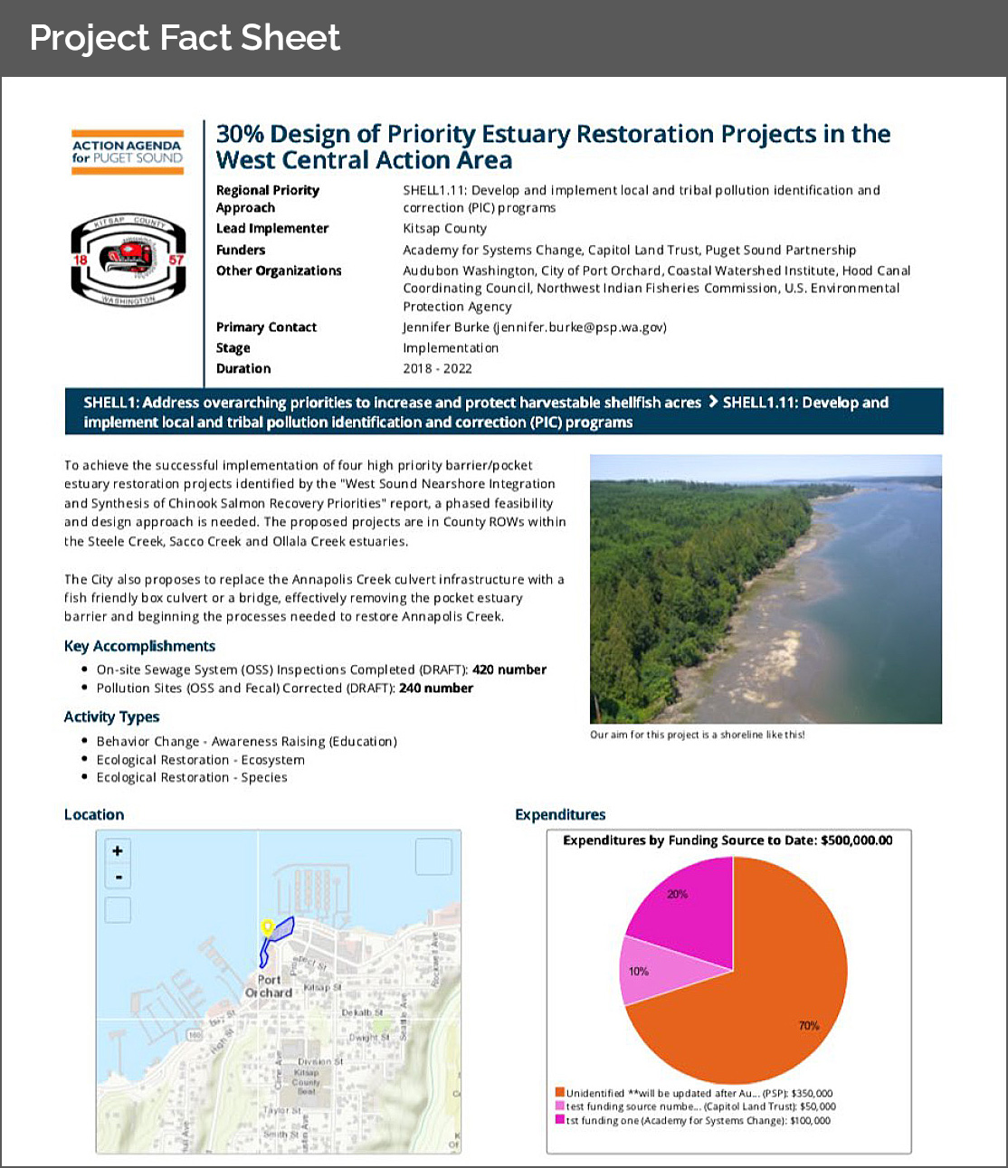
Easy-to-use tools for report generation, data sharing, and public engagement, including one page Project Fact Sheets (shown here)
Supports geospatial data import and live connections with GIS servers such as ArcGIS and GeoServer
Easily integrates with other sites, tools, and databases
One platform provides a website for public engagement and a secure administrative portal for registered users
Enables flexible content management with user friendly interface
Generates reports in a variety of formats
Promotes program transparency and accountability
Customized visual design to match your brand identity
“The online platform is a powerful tool that improves transparency and accountability and allows us to showase the great work being done.”
Kimberly Caringer | EIP Division Manager, Tahoe Regional Planning Agency
ProjectFirma Clients
EIP Project Tracker
Districts Project Tracker
Resources Forest Health Tracker
Endangered Species Database
Water Fund Project Tracker
Project Tracker
Action Agenda Tracker

Project Tracker
Project Tracker
Salton Sea Management Program
Conservation the Idaho Way Project Tracker
Project Tracker