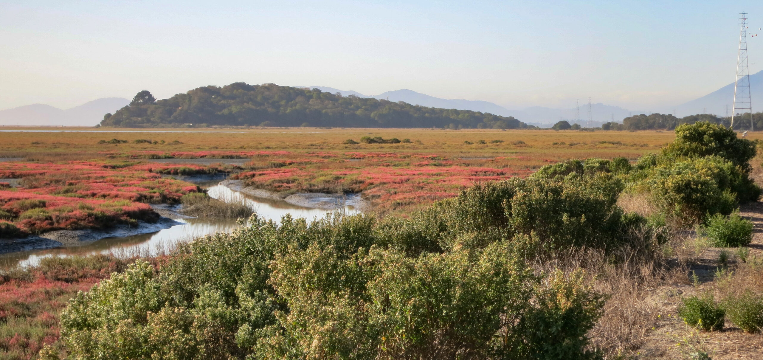
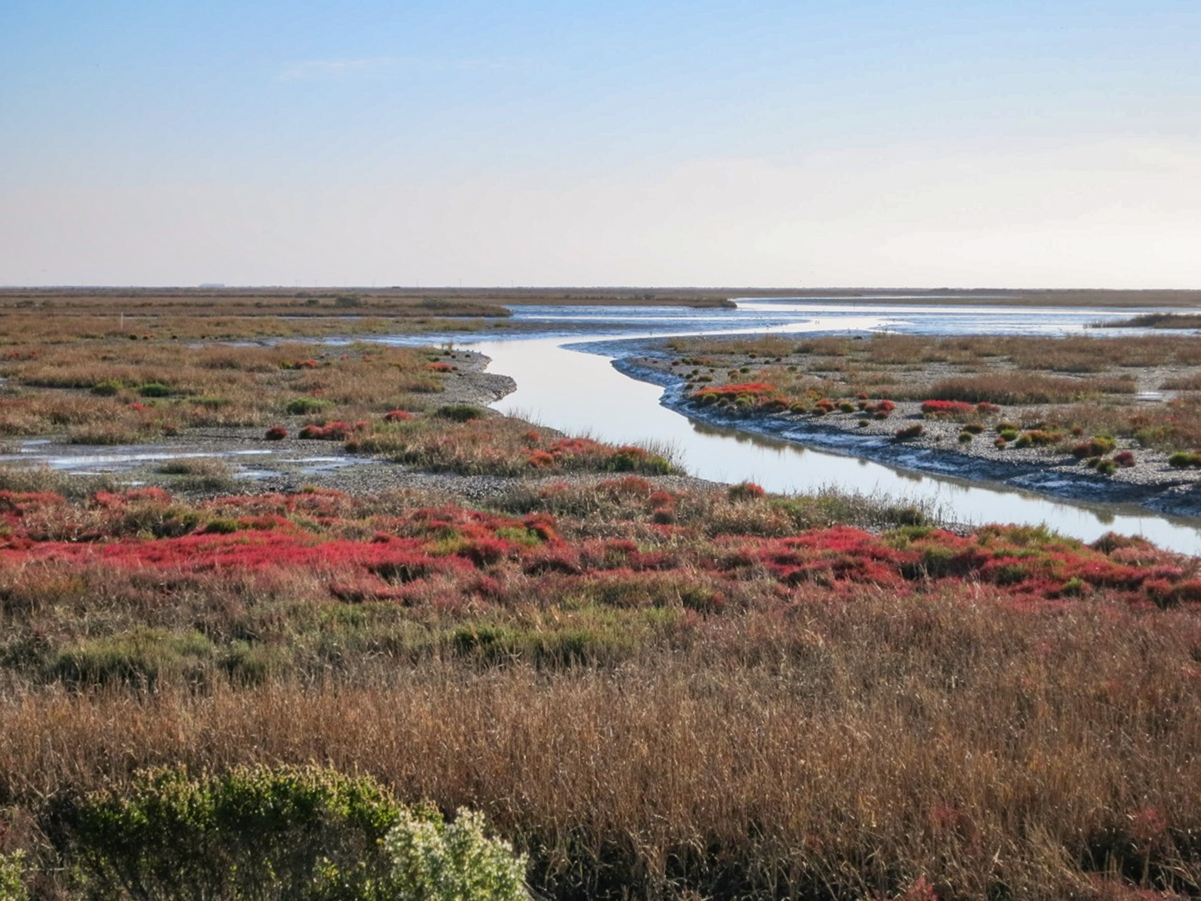
The Sonoma Baylands Wetland Restoration Project (Sonoma Baylands) has restored 348 acres of formerly diked farmland in southwestern Sonoma County and is considered one of San Francisco Bay’s pioneering restoration projects.
Why does this project matter?
The site, once part of an extensive tidal wetland system along the north margin of San Pablo Bay, was diked and drained for agriculture in the late 1800’s. The design approach was to create appropriate conditions whereby a marsh would evolve in response to natural processes. The design and implementation planned for natural sedimentation to raise the marshplain above dredged material placed on the site and to allow tidal channels to form naturally as tidal exchange increased and native marsh vegetation was established within the restoration site.
What is ESA doing to help?
ESA worked with the California Coastal Conservancy, the Sonoma Land Trust, and the Army Corp of Engineers to prepare the hydrology and geomorphology components of the restoration design. Before opening the site to tidal action, the team determined that clean dredged materials could be used to raise its surface elevation in order to speed the marsh’s geologic and biologic evolution. Using material dredged from a shipping channel project for the Port of Oakland, Sonoma Baylands became one of the first restoration project in the Bay Area to use dredged sediment. The team also pioneered the practice of allowing ecologic goals to determine the amount and placement of the dredged material. Due to its large size and windy environment, the design also incorporated features to limit wind wave energy within the site.
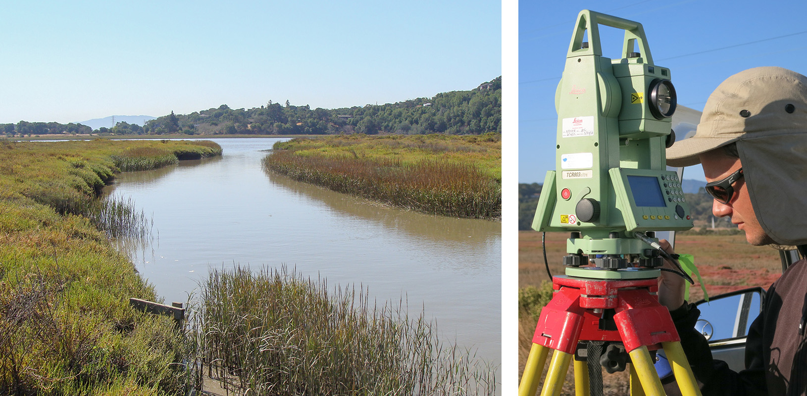
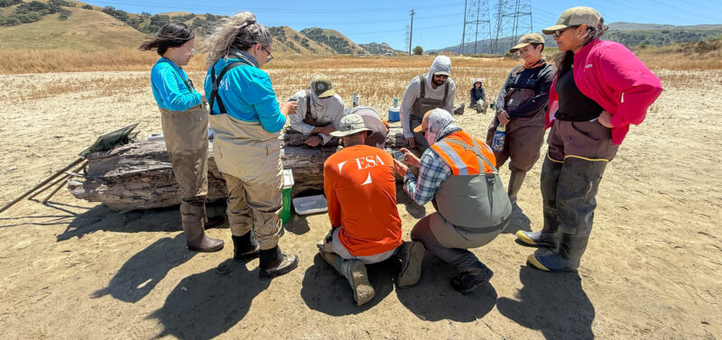
After nearly a decade of monitoring the wetlands, Managing Hydrologist Damien Kunz knows this site like the back of his hand. He can be seen above surveying the site for changes in topography and vegetation.
After the project’s completion in 1996, ESA conducted yearly monitoring of the restored tidal marsh through 2016. The monitoring included a combination of topographic surveying, photographic documentation, and water level monitoring to characterize the rate and pattern of outboard and inboard tidal channel erosion; changes in tidal prism, sediment deposition, and consolidation; constructed levee and peninsula subsidence, and vegetation establishment. Monitoring was also used to determine the occurrence of benthic macroinvertebrates, birds, and fish. The data gathered during the monitoring of this “First Generation” project was used to inform later second generation projects, like the Hamilton Wetlands Restoration, in the restoration design.
We use cookies to improve your experience on our site and to show you personalized content. By accepting cookies, you agree to our use of cookies as described in our Privacy Policy.
Functional
Always active
The technical storage or access is strictly necessary for the legitimate purpose of enabling the use of a specific service explicitly requested by the subscriber or user, or for the sole purpose of carrying out the transmission of a communication over an electronic communications network.
Preferences
The technical storage or access is necessary for the legitimate purpose of storing preferences that are not requested by the subscriber or user.
Statistics
The technical storage or access that is used exclusively for statistical purposes.The technical storage or access that is used exclusively for anonymous statistical purposes. Without a subpoena, voluntary compliance on the part of your Internet Service Provider, or additional records from a third party, information stored or retrieved for this purpose alone cannot usually be used to identify you.
Marketing
The technical storage or access is required to create user profiles to send advertising, or to track the user on a website or across several websites for similar marketing purposes.